SAGAR ISLANDS (SUNDERBAN)
130 km off Kolkata
 |
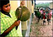
| Kids at Gangasagar Colony Primary
School |
It's raining heavily, as it
has been since morning. We alight from our car at Harwood Point
Lot #10, just past Diamond Harbour, after a nearly three-hour drive
from Kolkata. If the name sounds a trifle grand, the reality is
far removed from it. The place is a sea of umbrellas, screening
the several hundred villagers gathered there from the wrath of the
heavens above. There are some makeshift bamboo and burlap stalls
where dozens more have gathered in the vain hope of keeping themselves
dry. They are all waiting for the next "vessel" (as fishing
trawlers, which double up as a means of riverine public transport
when they're not catching fish, are called here) to ferry them across
the river. On a clear day, the silhouette of portions of the Sunderban
delta, where the Ganga, the Jamuna and the Brahmaputra meet the
sea, is visible from here.
We hire a country boat fitted with a diesel outboard motor for
a recce of the area. Our only protection against the elements
is an oil-stained tarpaulin sheet with mud patches. Our destination
is Kachuberia, down the river, which we reach in 45 minutes. It's
still pouring and visibility is poor. But all along the banks,
there are clear signs that the river is making steady inroads
into terra firma.
"What you see here is nothing. Closer
to the sea (about 17 km downriver), entire habitationshave
been gobbled up by the river,"
says Nepal Pradhan, our local
guide.
From Kachuberia, we drive 32 km to Gangasagar Colony, close
to where the Ganga meets the Bay of Bengal; this is a popular
pilgrimage spot. About 300-350 families of Ghodamara, Lohachara
and Suparibbhanga islands, which have been overrun by the rising
waters, have been rehabilitated here. These, we are told, were
just the "trailer". A report prepared by Jadavpur University's
School of Oceanogrphic Studies says: "Many more islands in
the Sunderban belt may similarly go underwater by 2020."
The reason: the sea is rising at an annual rate of 3.14 mm compared
to the global rate of 2.2 mm, causing massive soil erosion. "The
only way to stop this erosion is to plant larger numbers of trees
along the banks of the river and along the shoreline," says
Mantulal Mondal, Head Teacher at the local Gangasagar Colony Primary
School. "Our students, teachers, their families and other
local people are doing their bit; but it needs greater governmental
involvement," he says. Adds Ajoy Patra, Head of the local
Gram Panchayat: "The government should put up concrete embankments
to arrest the march of the tides."
 |
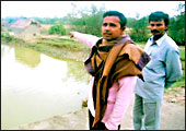
| Uncertain future:
Chandan Dolui (top) and his family have been rehabilitated
from Ghodamara islands to Gangasagar Colony. (Bottom) Badal
Chandra Giri (L) points to inroads made by the river, and
Nepal Pradhan |
 |
From the evidence at hand, that is obviously not happening. If
anything, the opposite seems to be the case. The authorities of
the nearby Haldia Port, had, a few years ago, erected a diversion
dam on the Hooghly near Agnimari Char in order to direct greater
water flows to the port. The dangers of tinkering with nature
became apparent when the gushing waters started eroding and then
gobbled up Ghodamara. Says a senior official of Haldia Port Authorities:
"Soil erosion and submersion of islands in the Sunderban
delta can be attributed to premature human settlement, among other
reasons. We only executed a duly approved and sanctioned plan."
Apart from the dislocation and devastation caused by floods,
rising sea levels also cause long-term economic disruption for
survivors. Sheikh Basir and Badal Chandra Giri were small but
prosperous farmers in Lohachara and Ghodamara, respectively; they
have now been rehabilitated in Gangasagar Colony. "Earlier,
we had nearly 75 bighas (1 bigha comprises 14,400 sq. ft) of cultivable
land each. Now the government has given us only 1.5 bighas each
in this new colony. It's difficult to run our families,"
says Giri.
The same story is repeated across the entire Gangetic Delta.
Unless the government and civil society take urgent steps to arrest
this situation, the entire Sunderban region, and large parts of
India's low-lying eastern coastal belt, stretching from West Bengal
to Tamil Nadu, will be submerged by 2040; 75 million families
will be uprooted; and the surging saline waters will render millions
of acres of fertile land uncultivable.
Says Kanti Ganguly, Minister, Sunderban Development, Government
of West Bengal: "Tackling global warming is beyond our capabilities.
We've urged Union Science and Technology Minister Kapil Sibal
to suggest what needs to be done. Meanwhile, we are planting mangrove
trees along the embankments and rehabilitating people from the
vulnerable zone to safer places."
So, the Ganga doesn't flow quiet any longer. |


